
26 Jan Ian Update
IAN UPDATE
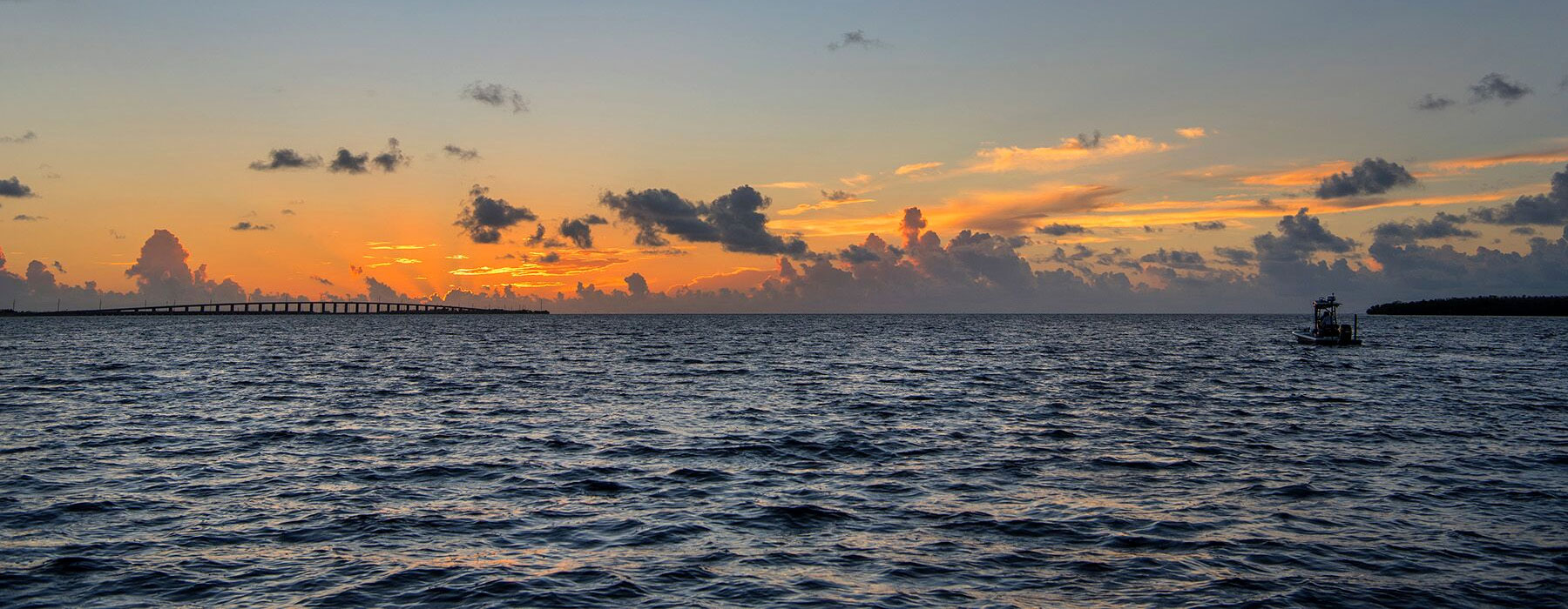
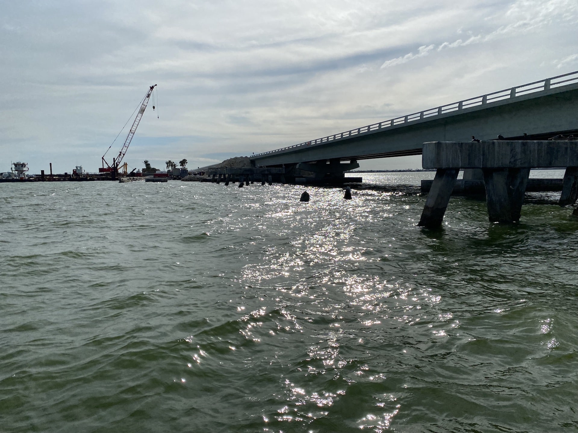
We have received many inquiries over the last few weeks about updates in the Ft Myers area post IAN. After hurricanes, it is best for a few reasons to run the affected areas after about 3 months to let the area settle, the initial major cleanup to be complete, and normal tide patterns to resume. We were in Ft Myers for a few days last week running from northern Charlotte Harbor including the Myakka River and past the two bridges into Harbour Heights all the way south into Estero Bay. The cleanup is still underway on the water as well as on land, but it appears there are no major obstacle issues on the waterways at this time impeding normal navigation patterns. The Sanibel causeway is fully repaired, but construction is still underway on either side of the bridges, with large new pilings going in along with massive amounts of fill and boulders which should insulate the bridges from storms in the future.
We ran the entire east and west side of Pine Island, including the major passes, for more than 350 miles doing nothing but mapping and surveying. We had negative tides for most of the day. The updated chart will include more than 1,000 edits, mostly to markers, signs, and buoys. We are endeavoring to include the Ft. Myers updates on all charts purchased and updates ordered starting no later than January 30. The updates are complete, and the chips will be available for shipping by this weekend.
As was the case after IRMA, we had varying reports in the weeks after the storm from ISLA users regarding needed changes to the charts ranging from a total redo to only minor changes needed. We received a few hysterical phone calls about the Pine Island area. One report was it was a total disaster and “the chart needs to be totally reworked and very little of the chart in the Ft. Myers area was currently correct”. We even got a call that “Oyster Bars had moved in Turtle Bay and south of Matlacha”. Other reports to us (including from a police agency working on rescue operations), indicated no major chart issues other than missing markers and debris/obstacles. We don’t know the truth until we get there ourselves and start surveying the area. We have been through this a few times over the years. In our experience, the initial shock of the damage to homes, floating debris, and other obstacles creates a bit of hysteria and some of the initial feedback we hear follows suit. It is certainly understandable given the amount of damage to infrastructure.
The good news is, just like was the case post IRMA, there are virtually no changes to Tracks on our chart. In this update, there was surprisingly only one track change in Ft. Myers down at Lovers State Park Beach, where a Sand Bar grew where you idle in behind the beach. The rest were very minor deviations where a track was altered a little to avoid a new obstacle. In fact, if anything, the area is easier to run now than it was before the storm with some Black tracks turning Red. That happened on the outside and inside of Turtle Bay. We are happy to report that the Oyster bars are the same now as they were before IAN. Even the major passes from Redfish Pass south all were confirmed mostly unchanged, and no Tracks needed to be moved due to shifting sand. The bars are deeper now overall and in some cases smaller. We even ran under the Bridge at Blind Pass and found the track to the Gulf was correct there, and the bars are smaller or mostly gone on the inside of the bridge. The large bar(s) south of Sanibel Causeway are much smaller and deeper. If you are running the area now using the chart from within the last year, you can get around just fine using it with no issues whatsoever. Our survey found that about 90% of the edits are due to missing navigational markers, signs, and buoys. The rest are obstacles we noted, which are likely to be around for an extended period of time, including trees and tree branches, wrecks, and man-made debris like boat docks and pieces of infrastructure.
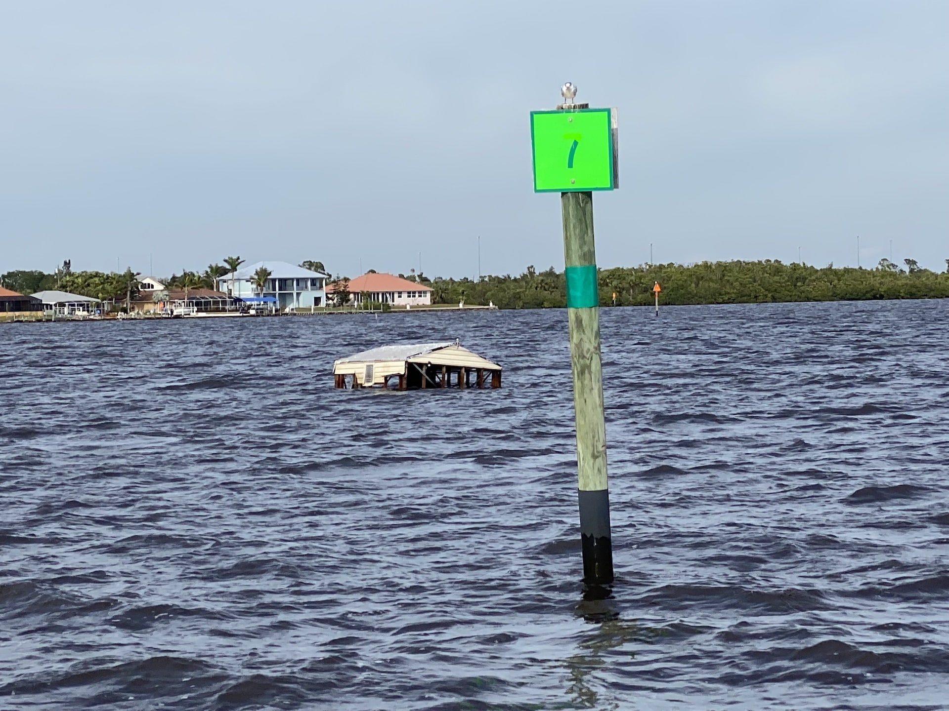
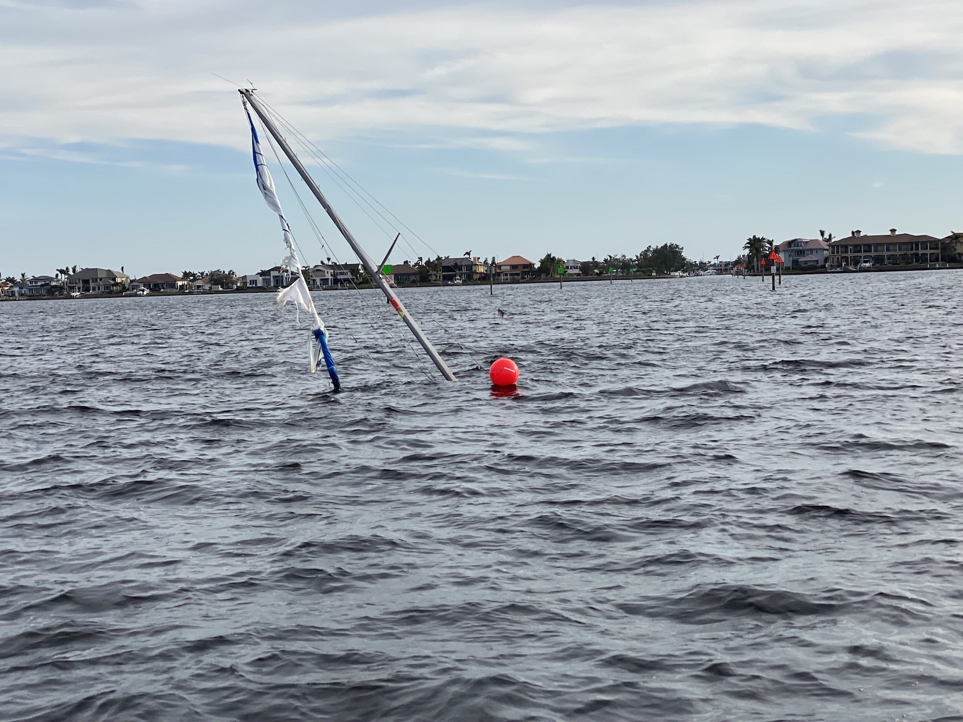
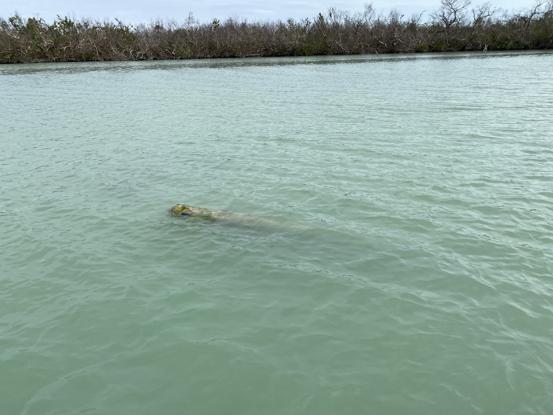
We found a couple of very dangerous obstacles which are dislodged large markers sunk and partially exposed at the water’s surface only about 10’ from a track. This is the case near Jewfish Creek at Cape Coral. If you don’t get the update right away, you should at least mark these coordinates in your GPS immediately so you can avoid it. The coordinates are N26 31.476 W 82 01.674. It’s in a narrow corridor, and it could sink your rig or damage it severely if hit at speed. The other is in an idle zone a few feet off a track south of Tween Waters Inn at Sanibel Island between Daymarkers 26 and 27. The coordinates are N26 29.921 W82 11.0009. We marked the debris we found that is in deeper water near a track or near where you may run. The really shallow flats where we could not run have lots of obvious small bushes and branches. Those obstacles in inches of water were not marked as they are obvious and you can’t run to most of them. We found tree limbs across the entire area surveyed. There are some large trees on the flats in 1’ to 4’ of water on the west side of northern Sanibel Island.
With respect to the navigational markers and signs, there are now hundreds of them totally missing. We found there are about 100 missing markers and signs in Matlacha Pass alone. The missing markers include even primary navigational routes such as the approach to Matlacha Bridge from the north. For instance, Green Daymarkers #79 and #81 are gone. They are not blown over – they are totally gone. But we also noted a few signposts that we added that were not on the previous chart.
The daymarkers are key to safe navigation, and we anticipate most will be replaced over the course of 2023, and that is likely the case for most of the signs as well such as Speed or Manatee signs. Consequently, we have decided to leave the markers and signs on the chart as they will likely be replaced in their original positions. For this update, we have edited the missing signs, posts, and marker #s with the word “missing”. Using the updated chart this way will make navigating much easier than removing the missing markers from the chart, as the markers are useful aids for traversing many areas and particularly sinuous places like Matlacha Pass.
If you find other obstacles that you think should be noted on the chart, the way to advise us is to idle to it, zoom all the way in on your GPS and then take your finger and put it on the screen exactly at the location and create a waypoint there. Then take a photo of the screen so the coordinates can be seen. Then text the photo to 407 463 7216, and we can take a look. The coordinates need to be exact.
Out And About
ISLA will not be exhibiting at the Miami Boat show in February. However, we will be there for a couple of days on the 17th and 18th (Friday and most of Saturday). If you are going to be there and want to update your chart at the show, contact us ahead of time to make arrangements.
We will be running the 10,000 Islands and the Naples area before May, and the Keys will be rechecked in April, May, and June.
Updated Florida Images Coming Soon
We have acquired all new images for all of Florida, and we are working to process them all right now. Fixing the images for FMT is an enormous endeavor. I just finished working on a new image for Florida Bay, and I have over 100 hours of work in that photo alone. The new images for the Keys will include an additional dataset of good resolution images that covers the patch reefs all the way to the lighthouses and even the Banks a couple of miles behind the 7 mile bridge. We are working to release the new images for South Florida first sometime late this summer. An update for North Florida with new images will be released sometime in the fall after South Florida is done. We cannot provide an exact date on anything as there are too many unknowns creating the product mostly due to unforeseen technical hardware and/or software setbacks which seem to be a matter of routine. We are working on it every day and are pushing for everything to be updated as soon as we can without skimping on the quality and details like some others.
We are still seeking a few ISLA users who are regular boaters and skilled in navigating their local waters to help us with updates for their local area two to four times each year all over Florida, noting new obstacles, needed track changes, marker changes, stakes, etc. If you are interested in being a part of this and have a penchant for details, call us anytime to discuss.