


06 Jan What Is the Best Marine GPS?
Centuries ago, people navigated the water using a complex system of paper maps, compasses, and other antiquated equipment. Now, thanks to the magic of modern technology, we have GPS chartplotters.
Rather than having to identify specific constellations or learn how to use a sextant, modern boaters can simply tap on a screen and they’re well on their way. However, one thing 19th-century sailors never had to contend with was deciding which of the many chartplotters on the market to buy.
If you plan to spend a significant amount of money (not to mention time on the water), you want to make sure you have the best marine GPS chartplotter. But how do you choose between them when each brand seems to have a devoted fanbase?
In this guide, we’ll guide you through the features you need to consider to make sure you’re confident in your decision.
Screen Size
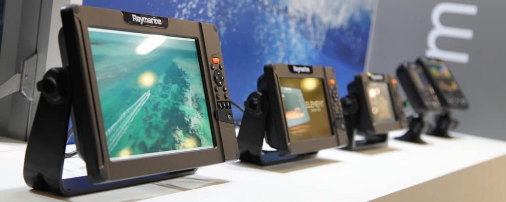
Marine GPS units come in a wide range of screen sizes. Generally speaking, 7- and 9-inch screens are the most popular, but 12-inch, 16-inch, and even 19-inch models are available as well.
Generally speaking, the best GPS for boating will have a large screen that’s visible from far away and gives you the ability to “split” your screen without losing visibility. However, you will also want to consider the limitations of your boat.
If the footprint of the unit exceeds the space available on your boat, it won’t matter how big the screen is.
Screen Resolution
Screen resolution is measured in pixels, a small point of light on a screen. The more pixels on a screen, the more detail that screen will be able to show.
Lower budget GPS units typically start at 384,000 pixels, while units with bigger screens may have as many as 2 million pixels.
Of course, size has a lot to do with your screen resolution. For example, if you are looking at two different sized screens with the same amount of pixels, the smaller screen will look cleaner and more detailed in comparison.
Another thing to consider is the chart you plan on using (more on this later). If you opt for a map with a very high resolution, it will look best on a high resolution screen.

Map Accuracy
In order for a unit to be considered the best GPS for boating, it needs to navigate with high accuracy.
In the past, this was a huge problem among marine chartplotters. Prior to 2000, accurate GPS was strictly reserved for the military. Once this technology became available to civilians, precision was vastly improved.
However, this doesn’t mean that all marine GPS chartplotters have access to the most accurate map.
GPS units are simply devices that show where you are in relation to a specific point on a map. With access to the same map, most GPS devices will pinpoint the same boat as being in the same location within a few feet of accuracy).
However, the problem is that the preloaded maps provided with most marine GPS units are not as accurate as they could be. To overcome this issue, many boaters turn instead to a third-party map.
Third Party Maps
Despite their popularity (or perhaps because of it), third-party maps aren’t supported by all chartplotters.
For instance, Garmin units are only able to support their own Navionics charts. Even though their GPS units come with a slot for a mapping chip, this is purely so boaters can run a Navionics (Garmin) chip.
If you want to have the freedom of using a more accurate third-party map, we suggest steering away from Garmin in favor of a brand like Lowrance, Simrad, or B&G as these units run the most 3rd party charts in the marketplace.
What Is the Best Marine GPS Chartplotter?
We have used a wide range of marine GPS chartplotters over the years and found that most of them tend to be equally capable in most areas. All models are relatively durable, display maps accurately, and are equally easy to use once you grow accustomed to the interface.
The one thing that makes the biggest difference is what map you’re using.
The best marine GPS units are those using maps with a high degree of accuracy. For this reason, we suggest finding the chart you want to use first, then select a GPS unit that supports it.
The Best GPS For Boating
In our experience, most marine maps are simply too inaccurate for reliable inshore navigation on the water outside of a main marked channel. Garmin’s Navionics system is well known for showing boaters running on land. For those who like to navigate inland waterways, such errors could lead to you running aground.
Just like you, we were frustrated with Garmin’s inaccurate charts and general lack of regard when it came to fixing their shortcomings. We started ISLA Mapping as a way to create a chartplotter we could trust.
Florida Marine Tracks and Louisiana Marine Tracks are unparalleled in to-the-foot accuracy and ease of use. We’ve had hundreds of customers rave about the difference between their ISLA map and other manufacturer’s premium charts and preloaded maps that came with their GPS unit.
Whether you’re looking for a specific area or the entire coastline, our Louisiana and Florida marine maps will have you navigating in comfort and safety.